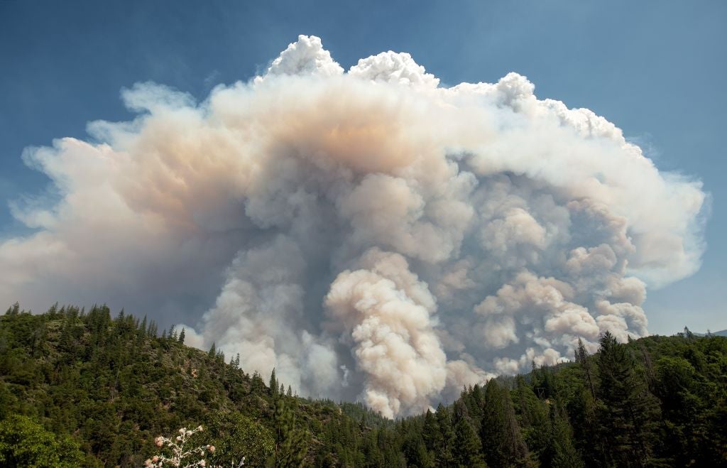
California Wildfire Produces Fire Clouds and 'Firenadoes'
A devastating California wildfire has taken over parts of Northern California, already claiming the lives of six people. Now, fire clouds and what some are calling "firenadoes" are hovering over the fires.
Pyrocumulus "fire" clouds have formed above impacted areas, creating "basically its own localized weather system," according to CNN Weather. These clouds form similarly to how clouds we're most familiar with do, except they occur under faster and hotter conditions. The strong heat of the fire pulls moisture from burning vegetation, which then combines with smoke particles and condenses. Inside, conditions resemble the thunderstorms they appear to be from the outside.
The wildfire in California has also lead to what us widely being called "firenadoes." Essentially, they're a tornado in the midst of the mess of fire and ash. The video below that CNN Weather Center tweeted looks frighteningly like the end of the world.
So far, no travel waivers have been issued due to the wildfire, and Flight Aware shows fairly normal conditions at airports in California, but TPG is monitoring the issue in case anything arises.
According to USA Today, the fire itself has spread across more than 150 square miles, and more than 30,000 Californians continue to be evacuated from affected or potentially dangerous areas. According to officials, just 20% of the fire is currently contained.
However, it seems like fire responders seem to have gained a greater control over the situation in California. "We're feeling a lot more optimistic today as we are starting to gain some ground rather than be in the defensive mode all the time," one incident commander, Bret Gouvea, said.

TPG featured card
at Capital One's secure site
Terms & restrictions apply. See rates & fees.
| 5X miles | Earn 5X miles on hotels, vacation rentals and rental cars booked through Capital One Travel |
| 2X miles | Earn unlimited 2X miles on every purchase, every day |
Pros
- Stellar welcome offer of 75,000 miles after spending $4,000 on purchases in the first three months from account opening.
- You'll earn 2 miles per dollar on every purchase, which means you won't have to worry about memorizing bonus categories
- Rewards are versatile and can be redeemed for a statement credit or transferred to Capital One’s transfer partners
Cons
- Highest bonus-earning categories only on travel booked via Capital One Travel
- Enjoy a one-time bonus of 75,000 miles once you spend $4,000 on purchases within 3 months from account opening, equal to $750 in travel
- Earn unlimited 2X miles on every purchase, every day
- Earn 5X miles on hotels, vacation rentals and rental cars booked through Capital One Travel
- Miles won't expire for the life of the account and there's no limit to how many you can earn
- Receive up to a $120 credit for Global Entry or TSA PreCheck®
- Use your miles to get reimbursed for any travel purchase—or redeem by booking a trip through Capital One Travel
- Enjoy a $50 experience credit and other premium benefits with every hotel and vacation rental booked from the Lifestyle Collection
- Transfer your miles to your choice of 15+ travel loyalty programs
- Top rated mobile app


