'Turn left at that cloud' — How pilots do (and don't) navigate
My dad has said to me for years, "It's easy for you pilots up there. No traffic lights. No road signs. Just go where you want." Now, whilst this dad joke is mildly amusing, does he have a point? Is it really as easy as pointing the nose at Los Angeles and off you go? Agreed, there are no roundabouts and no BMW drivers to contend with, but there must be other factors to consider? Here's how we do it.
The Highway Code of the Sky
For any system to function efficiently, you need rules. As the road system in the UK has the Highway Code, the skies have their own set of rules. Right from the very start of their training, pilots have to be well versed in these rules. Who has the right of way in the sky? How high should you fly above a built up area? What's the minimum weather conditions in which you can take off? The full list of rules is detailed in the Air Navigation Order. If you like long reads, this one is for you. Having a working knowledge of these rules is essential for all pilots. But how do these rules translate into every day usage?
On the roads, things can get complicated enough. Cars overtaking on your left, trucks merging from the right and a whole number of exits and turnoffs to confuse you. The same issues are relevant to the sky. In order to give some order to all this, airspace is divided into different types.
Whilst General Aviation (smaller, mostly private aircraft) traffic is a significant part of air traffic, for this article we're just going to consider commercial air traffic.
The airspace in the UK is divided into two types: controlled and uncontrolled airspace. Commercial flights spend most of their time in controlled airspace, where they are subject to instructions by Air Traffic Control (ATC). As a result of the high level of navigational accuracy required, aircraft and pilots operating in this airspace need to be qualified to a certain standard. It is ATC's job to ensure that all traffic is safely separated from each other. Being some of the busiest airspace in the world, the skies above the UK are then divided up into different areas called Flight Information Regions, or FIRs. This ensures that the ATC doesn't be become overloaded with too many flights, as show in the map below.

The London FIR is responsible for traffic over England and Wales, and the Scottish take charge of flights over Scotland and Northern Ireland. The Shanwick Oceanic FIR is responsible for flights over the Atlantic.
Whilst this divides the UK into manageable areas, does this mean that aircraft can go wherever they want? Not quite.
Within these areas, there's still a lot of traffic that needs to be managed. Not only do you have flights departing and arriving UK airports, there's also a large number of aircraft routing between North America and Europe, the Middle East and Asia. All these fights, particularly the arrivals and departures, need to be carefully managed. In order to do this, aircraft are controlled into streams on airways. These are, in effect, motorways in the sky.

Most airways have a defined flow direction to ensure that all traffic within the airway are flying in the same direction. Quite often, if an airway has traffic heading west, just to the north or south there will be another airway with traffic heading east. A good example of this is over south Wales. The westbound airway caters to traffic leaving London bound for North America. The eastbound airway serves flights arriving into London from North America.
But how do pilots know where exactly these airways are? Unlike motorways on the ground, it's not so easy to paint lines in the sky. Even if you could, when it's cloudy, it would be impossible to see the lines. However, even though you can't paint a physical line, you can paint an invisible one.
Point-to-Point Navigation
During World War II, aircraft returning from missions over Germany would often become lost during bad weather. To help them return home safely, navigation beacons were developed that would send out a signal, which the aircraft would receive and the pilots could then interpret which way they had to fly. The technology of these beacons developed over the years, enabling pilots to not only be able to tell which direction the beacon is but also how far they are from it. When you know both these factors, you can then navigate from one beacon to the next, creating the first airways. The beacons would also act as junctions in the sky. By depicting these airways on a chart from beacon to beacon, pilots could then navigate wherever they wanted, simply flying from 'junction to junction'.

This beacon to beacon navigation worked well for a number of years, but the infrastructure needed to make this system work is significant. If the beacon broke, pilots didn't know where it was so they couldn't navigate on that airway. They also only had a finite useful range. If you wanted to navigate accurately over vast open expanses, for example oceans, this system wouldn't work. What was needed was a system where there's no need to rely on ground-based features. Something which aircraft could still determine their position by and still navigate accurately. For this, instead of looking down for guidance, aircraft started to look up.
Enter GPS Navigation
With the arrival of GPS, along with the on board Inertial Reference System, aircraft are now able to pinpoint their position with utmost accuracy. Instead of airways relying on physical beacons on the ground to pinpoint the junctions, these can now be defined by a GPS position. These waypoints are given five-letter names and often have some connection with their physical point on the ground. Some of these are pretty interesting.
The waypoint TIGER, on the arrival into London Heathrow, is in Ashdown Forest, East Sussex — the location where A.A. Milne created 100 Acre Wood in the Winnie the Pooh books. Houston, Texas, synonymous with the oil industry, has the sequence of points PPUMP, PPIPE, DRLLR and PTROL on one of the arrivals. And then, in the true American patriotic way, the arrival into Baltimore, Maryland has STARZ, STRPS and BRAYV.

Now, this is all well and good using our one dimensional motorway example. One lane to go one way, another lane to go the other. But our airways in the sky have another aspect to them. The vertical aspect.
When 2D Becomes 3D
Imagine driving on the highway and then having to deal with cars coming from below and above you. Doesn't bear thinking about, right? If it was a free-for-all like this in the skies, it would be chaos. Flights departing the UK need to take off from their departure airport and climb up to their cruising altitude. Aircraft arriving into the UK need to descend from their cruising altitude and land at their destination airport. And let's not forget all those flights who are just passing through from Europe to North America. This is why the airspace is structured like it is.
We've already seen how the airspace is divided laterally, but how does this work vertically?

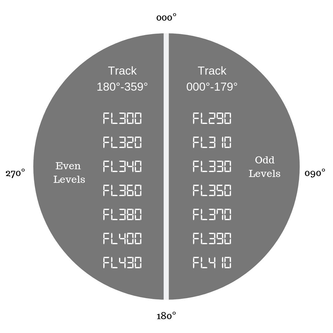
Depending on the direction of flight, aircraft fly at different altitudes. If you missed my article on how pilots decide how high to fly, it's well worth a read. Simplified, aircraft are always separated by at least 1,000 feet vertically. They then abide by what is known as the semicircular rule. Westbound flights fly at even levels, eastbound flights fly at odd levels. By doing this, even in airways with traffic flowing in both directions, safe separation is always maintained.
As aircraft get closer to an airport, the airspace around them gets busier and busier. If you've ever seen the lights of aircraft lining up to land at Heathrow in the early morning, you'll know what I mean. As a result, the vertical airspace is also divided up into different sections, as shown below.

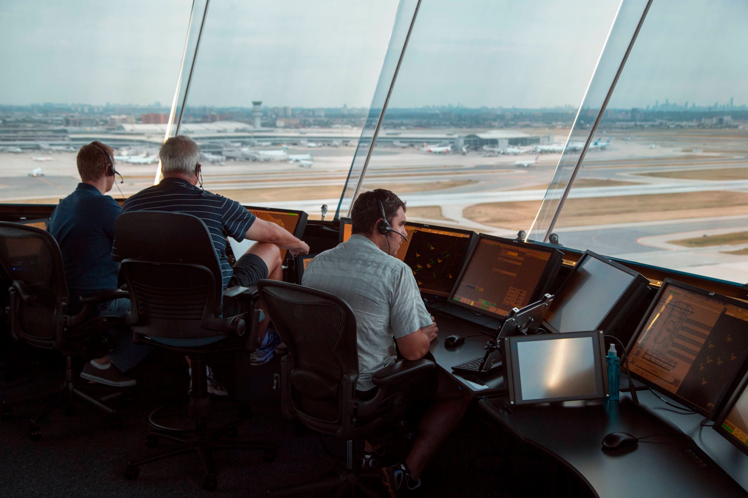
Each of the areas shown above will be the responsibility of a different ATCO, or Air Traffic Control Officer. As the aircraft descends toward its destination airport, the ATCO will transfer the flight to the next sector. This is done by giving the pilots a new radio frequency to talk to the ATCO controlling that area.
As the aircraft nears the runway, they are finally handed over to the control tower at the airport, which sees them the last few thousand feet onto the ground and to the gate. The same principles apply on departure, just in opposite.
So now we know how the airspace is structured, we can look at how this manifests itself in a normal flight.
Putting it Into Practice
As you read this, thousands of Brits are at airports across the country, ready to fly off for their summer holiday. So how do their pilots use what we've learned above to get them there safely?
Normally, a few hours before the flight, the airline's flight planning department will draw up a flight plan — the series of waypoints and airways the aircraft will take to get to its destination. This will take into account the weather en route, likely delays from ATC due to capacity and other restrictions to airspace, to name but a few aspects. They will then file this flight plan with ATC.
Around an hour before the flight, the pilots will report at the airline's briefing center and print the relevant paperwork, including the flight plan. This is a slightly longer version of the plan submitted to ATC. They will check this against the forecast weather for the route and destination and also check any relevant notices that may affect the flight. From this version of the flight plan, they'll be able to determine what altitude they've been planned to fly at, how fast and any significant high terrain on the route.

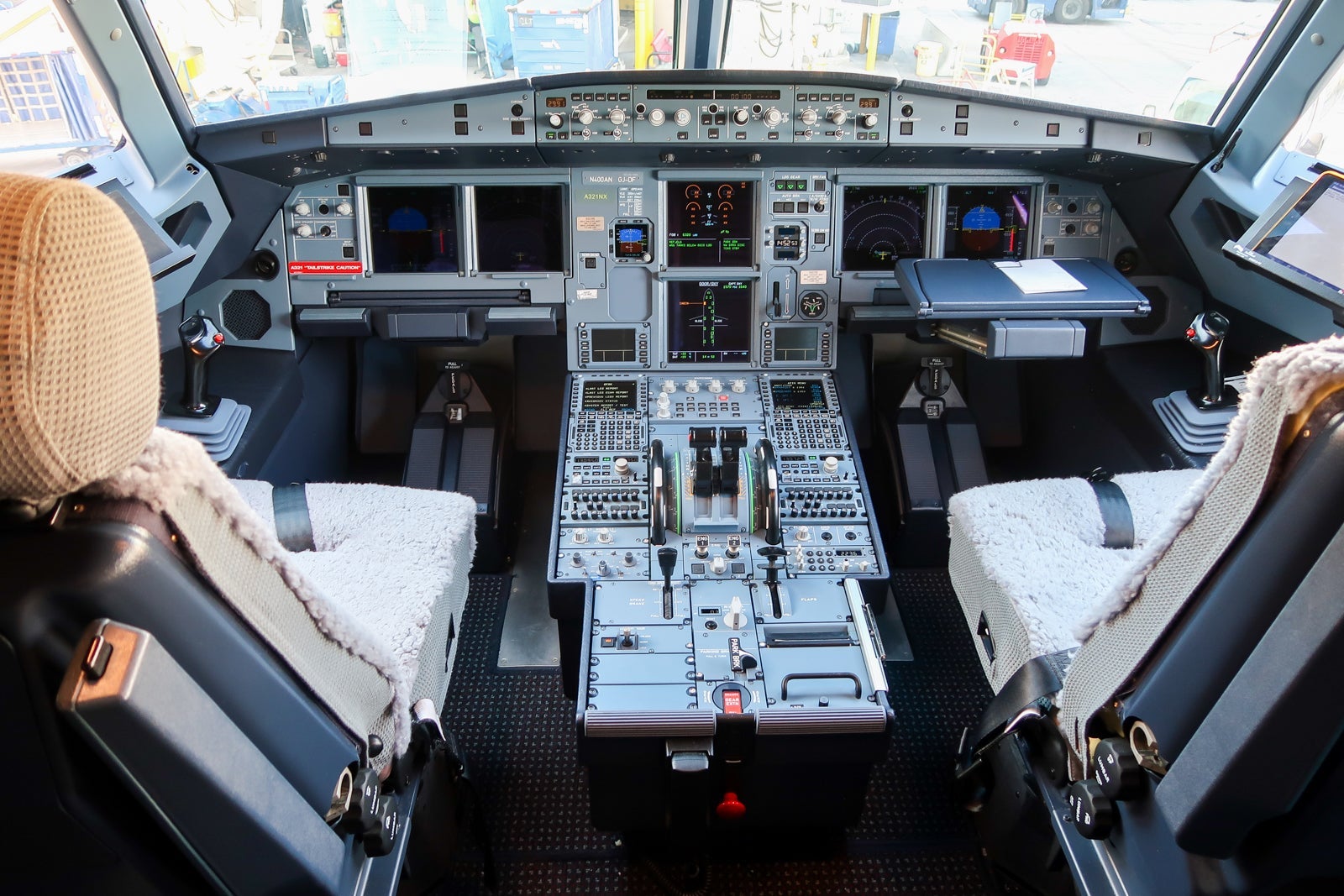
Once on board the aircraft, the pilots set up the flight management computer. To do this, the planned route is downloaded into the computer and the pilots then check this against their printed copy to ensure that the aircraft plan is the same as the filed plan. Like any computer, the output performance is only as good as the data you feed in. This flight plan then forms the basis of the aircraft navigation for the entire flight.
A Word on the Autopilot
Ahh, the autopilot. The most misunderstood aspect of commercial aviation. Ask any pilot and I'm sure they will have lost count of the number of times they've heard someone say, "Doesn't the autopilot do all the work?"
The autopilot is like the device you're reading this article on now. If you were to head over to your email app and start writing a message, who's composing the email? You or your device? If you were to hold down the 'h' key, it will write 'hhhhhhhhhhhh' beautifully across the screen but it doesn't mean very much. It's the same with the autopilot. It's only as good as the information you give it.
Once airborne, the pilots will make the autopilot to follow the programmed route. If the pilots have loaded the route incorrectly, the autopilot won't correct that. The autopilot will also not control the vertical aspect of the flight, it needs instructions from the pilots. With this in mind, the pilots will always be closely monitoring what the autopilot is doing to make sure that the intended actions are being taken as they fly from point to point.
Bottom Line
Aircraft navigation is a complex area of which this article has just scratched the surface. Advances in navigational technology has enabled a greater number of aircraft to use the same skies more safely than ever before. In later articles, I'll discuss how pilots use navigational aids to land in bad weather and how the latest GPS technology is enabling aircraft to fly routes into airports like Innsbruck and the Seychelles far more accurately and thus, more safely.
TPG featured card
at Capital One's secure site
Terms & restrictions apply. See rates & fees.
| 5X miles | Earn 5X miles on hotels, vacation rentals and rental cars booked through Capital One Travel |
| 2X miles | Earn unlimited 2X miles on every purchase, every day |
Pros
- Stellar welcome offer of 75,000 miles after spending $4,000 on purchases in the first three months from account opening. Plus, a $250 Capital One Travel credit to use in your first cardholder year upon account opening.
- You'll earn 2 miles per dollar on every purchase, which means you won't have to worry about memorizing bonus categories
- Rewards are versatile and can be redeemed for a statement credit or transferred to Capital One’s transfer partners
Cons
- Highest bonus-earning categories only on travel booked via Capital One Travel
- LIMITED-TIME OFFER: Enjoy $250 to use on Capital One Travel in your first cardholder year, plus earn 75,000 bonus miles once you spend $4,000 on purchases within the first 3 months from account opening - that’s equal to $1,000 in travel
- Earn unlimited 2X miles on every purchase, every day
- Earn 5X miles on hotels, vacation rentals and rental cars booked through Capital One Travel
- Miles won't expire for the life of the account and there's no limit to how many you can earn
- Receive up to a $120 credit for Global Entry or TSA PreCheck®
- Use your miles to get reimbursed for any travel purchase—or redeem by booking a trip through Capital One Travel
- Enjoy a $50 experience credit and other premium benefits with every hotel and vacation rental booked from the Lifestyle Collection
- Transfer your miles to your choice of 15+ travel loyalty programs
- Top rated mobile app


